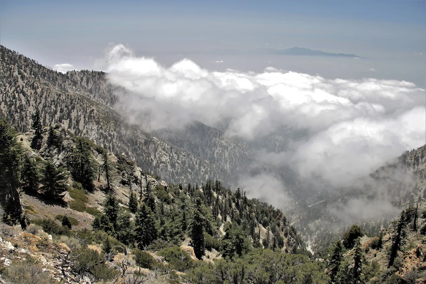
Icehouse Canyon Trailhead is one of the most popular hiking destinations in the Angeles National Forest near Mount Baldy. The trail follows a scenic, tree-lined canyon with a year-round creek, histori...
Icehouse Canyon Trailhead is one of the most popular hiking destinations in the Angeles National Forest near Mount Baldy. The trail follows a scenic, tree-lined canyon with a year-round creek, historic cabins, waterfalls, and diverse mountain vegetation before climbing to Icehouse Saddle. From the saddle, hikers can continue to peaks such as Ontario Peak, Cucamonga Peak, and Bighorn Peak. It is a favorite destination for hiking, wildlife viewing, photography, and nature exploration, offering both shaded lower trails and panoramic mountain vistas.
OpenMon - Fri 8:00 am - 4:30 pm
Sat & Sun 8:00 am - 6:30 pm
Additional Information
Pincode: 91759
Facilities
Car ParkingFree - WifiTransporation
Customer Review
Been here a couple of times recently. First did Three T's Trail clockwise on a Sunday morning in August - this required me to walk on Baldy Road for a couple of miles uphill to get to Manker Flats, then take the trail to Baldy Notch and return via Icehouse Canyon. The paved trails are no fun, and also took me 5 minutes to find parking at 7:40am on Sunday. Second time was when I did the Cucamonga, Bighorn, and Ontario Peaks on a Friday morning in October - this time, found parking immediately right at the trailhead, and also did trailhead to saddle both ways. Icehouse Canyon trail climbs 2500 feet straight up to the saddle from the trailhead in 3.5 miles, so be prepared for that. Nothing dangerous, and trail condition is good. There's a wide flowing creek alongside the trail for the first mile, but after that, I'm not aware of any water source until Baldy Notch. From the saddle, you can go left to Three T's, or right up to Cucamonga, or right down to Ontario, and all are very well marked. You need to display either an Adventure Pass or a National Parks pass in your vehicle. There's a warning at the trailhead that says you'll be fined 130$ otherwise. Also need to carry a permit into Cucamonga Wilderness which starts pretty much a mile in from the trailhead. This permit can be obtained online in advance or by filling out a slip at the trailhead itself.
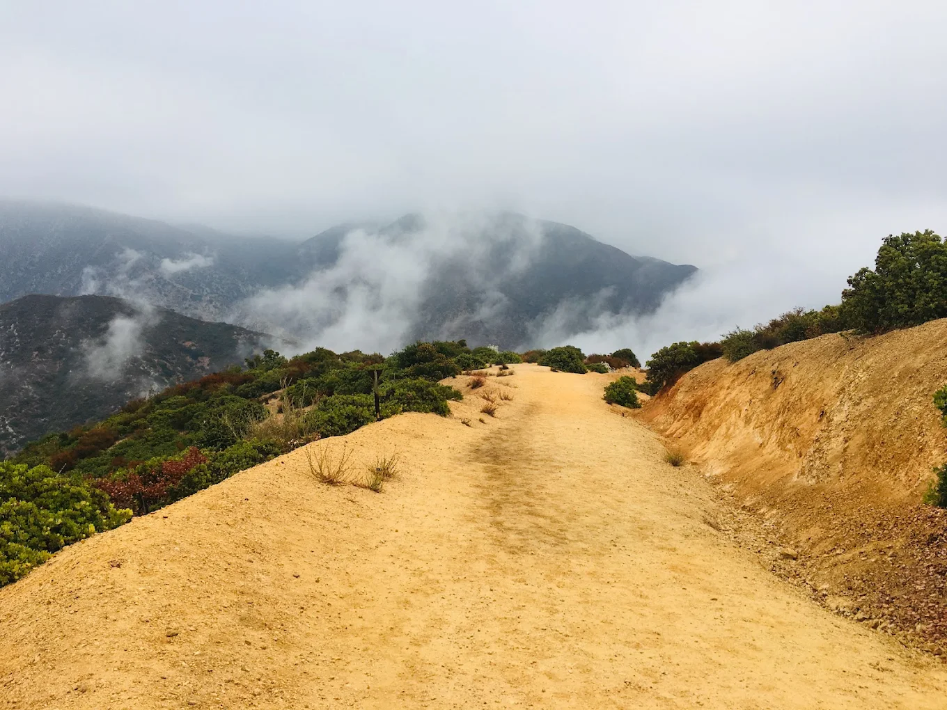
Potato Mountain is a popular hiking destination in the Angeles National Forest near Claremont, California. Rising to an elevation of approximately 3,422 feet, the mountain offers panoramic views of th...
Potato Mountain is a popular hiking destination in the Angeles National Forest near Claremont, California. Rising to an elevation of approximately 3,422 feet, the mountain offers panoramic views of the Inland Empire, San Gabriel Valley, and surrounding peaks. The trail is known for its moderate challenge, featuring steady elevation gain, scenic chaparral landscapes, and opportunities for birdwatching, wildlife viewing, photography, and trail running. Hikers can access the summit via the Palmer Evey Trail, which connects to the Claremont Hills Wilderness Park trail network.
Potato Mountain has become my go-to spot for a quick but solid hike. It’s a great out-and-back trail with just the right elevation to get a good workout in. I’ve had countless early mornings and sunrises up here, and it never disappoints—the views are worth every step. The trail offers a good challenge, but it’s also approachable enough for beginners and casual hikers to conquer without feeling overwhelmed. The only downside is that with the recent parking restrictions, it’s a bit trickier to start the hike from Mount Baldy Road. Still, once you’re on the trail, it’s absolutely worth it. If you’re looking for a local hike that gives you both a workout and beautiful scenery, Potato Mountain is definitely a go-to.
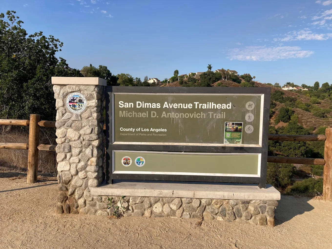
San Dimas Avenue (Michael D. Antonovich) Trailhead
1079 S San Dimas Ave, San Dimas, CA
4.7
(110 reviews)
Specialties
HikingTrail RunningMountain BikingHorseback RidingDog Walking (Leashed)Bird WatchingWildlife ViewingNature PhotographySeasonal Creek CrossingsPicnic Areaand Access to Walnut Creek Nature Park and Bonelli Regional Park.
About Business
San Dimas Avenue (Michael D. Antonovich) Trailhead is the primary access point to the scenic Michael D. Antonovich Trail, a popular multi-use trail in San Dimas, California. Located near the foothills...
San Dimas Avenue (Michael D. Antonovich) Trailhead is the primary access point to the scenic Michael D. Antonovich Trail, a popular multi-use trail in San Dimas, California. Located near the foothills of the San Gabriel Mountains, the trail features shaded canyon paths, seasonal creek crossings, native oak and sycamore trees, and panoramic views. It is a favorite destination for hikers, trail runners, mountain bikers, horseback riders, birdwatchers, and families seeking a peaceful outdoor experience. The trail connects to Walnut Creek Nature Park and the Bonelli Trail system.
This is a free place to park for hiking the Antonovich Trail. The trail has some graffiti, and is well maintained and is shaded and has many creek crossings. The trail is also shaded most of the way, so it is a good summer hike.